


-
 Go to download page →
-

Glendo State Park
Click here to view nowVisit our about page to find out more about our site
-
 Visit Our Facebook Page!

Maps & Brochures - Glendo
Environmentally Friendly Option:
- Glendo Brochure
- Glendo Park Map
- First-Come, First-Served, 2024
- Glendo Trail Map GeoPDF
- Trails Map North
- Trails Map South
- Hunting Map
- Bennett Hill
- Colter Bay
- Custer Cove
- Gravel Point
- Lakeshore
- Mule Hill
- Red Hills
- Reno Cove
- Sagebrush
- Sandy Beach Dune
- Sandy Beach Willow
- Shelter Point
- Soldier Rock
- Waters Point
- Whiskey Gulch
 |
Site Status |
||||||||
 |
Hours |
||||||||
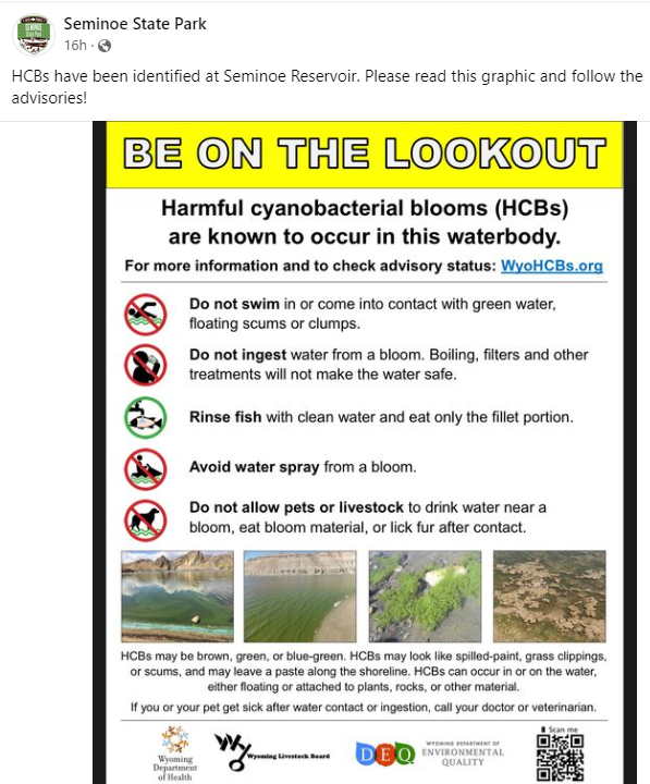
Attention: HCB Advisories
Notifications: All seasonal water is turned on. HCB Advisories in Effect ↪ Find Out More ↪ Download Flyer
Access to North Platte River below Glendo Power Plant in the Wetlands Area is currently closed to vehicular, bicycle, and foot traffic. The park is open year-round for day use and camping. Day use permits are required from 6AM to 10PM, and camping permits are required from 10PM to 6AM. Fee booths are open Mon-Sun, from Memorial Day to Labor Day. Otherwise, fees can be paid by cash, check, or credit card at canisters and kiosks stationed at park entrances, which are available 24/7.
|


